XYZ軟體急先鋒
PhotoLinker v2.2 MacOSX 軌跡照片同步 英文破解版
 -=-=-=-=-=-=-=-=-=-=-=-=-=-=-=-=-=-=-=-=-=-=-=-=-=-=-=-=-=-=-=-=-=-=-=-=
軟體名稱:PhotoLinker v2.2 MacOSX 軌跡照片同步 英文破解版
語系版本:英文版
光碟片數:單片裝
破解說明:
系統支援:WIN 9x/WIN ME/WIN NT/WIN 2000/WIN XP/WIN 2003
軟體類型:MAC麥金塔專用軟體
硬體需求:PC
更新日期:2010/7/7
官方網站:http://www.earlyinnovations.com/photolinker/
中文網站:http://www.earlyinnovations.com/photolinker/
軟體簡介:
銷售價格:80
-=-=-=-=-=-=-=-=-=-=-=-=-=-=-=-=-=-=-=-=-=-=-=-=-=-=-=-=-=-=-=-=-=-=-=-=
破解說明:請使用core_keygen序號機產生序號
軟體簡介:
PhotoLinker v2.2 MacOSX 軌跡照片同步 英文正式版
官方網址:http://www.earlyinnovations.com/photolinker/
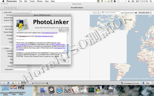
PhotoLinker 是一套可以讓你的 GPS 軌跡同步到照片 EXIF 的 Mac 工具
PhotoLinker provides an unprecedented level of map, GPS track and
photo tag interactivity, making photo annotation a compelling
project and not a dreadful chore.
Key features include:
* A completely customizable metadata editor to facilitate a
streamlined and efficient workflow. PhotoLinker complies with the
recently released (9/2008; rev 2/2009) recommendations of the
Metadata Working Group, ensuring proper handling of your photos'
metadata.
* Interactive geotagging with live updates to proposed locations
as geotagging critieria are changed. Photos can also be manually
geotagged by pinpointing a location on a map, entering the
coordinates manually, or tagging them to waypoints.
* PhotoLinker's track and waypoint browser handles years of data
and millions of track points imported from your computer or
downloaded directly from your GPS receiver. Tracks are
automatically cataloged by date and displayed on an interactive
map where the size and color can be adjusted.
-=-=-=-=-=-=-=-=-=-=-=-=-=-=-=-=-=-=-=-=-=-=-=-=-=-=-=-=-=-=-=-=-=-=-=-=
-=-=-=-=-=-=-=-=-=-=-=-=-=-=-=-=-=-=-=-=-=-=-=-=-=-=-=-=-=-=-=-=-=-=-=-=
軟體名稱:PhotoLinker v2.2 MacOSX 軌跡照片同步 英文破解版
語系版本:英文版
光碟片數:單片裝
破解說明:
系統支援:WIN 9x/WIN ME/WIN NT/WIN 2000/WIN XP/WIN 2003
軟體類型:MAC麥金塔專用軟體
硬體需求:PC
更新日期:2010/7/7
官方網站:http://www.earlyinnovations.com/photolinker/
中文網站:http://www.earlyinnovations.com/photolinker/
軟體簡介:
銷售價格:80
-=-=-=-=-=-=-=-=-=-=-=-=-=-=-=-=-=-=-=-=-=-=-=-=-=-=-=-=-=-=-=-=-=-=-=-=
破解說明:請使用core_keygen序號機產生序號
軟體簡介:
PhotoLinker v2.2 MacOSX 軌跡照片同步 英文正式版
官方網址:http://www.earlyinnovations.com/photolinker/
PhotoLinker 是一套可以讓你的 GPS 軌跡同步到照片 EXIF 的 Mac 工具
PhotoLinker provides an unprecedented level of map, GPS track and
photo tag interactivity, making photo annotation a compelling
project and not a dreadful chore.
Key features include:
* A completely customizable metadata editor to facilitate a
streamlined and efficient workflow. PhotoLinker complies with the
recently released (9/2008; rev 2/2009) recommendations of the
Metadata Working Group, ensuring proper handling of your photos'
metadata.
* Interactive geotagging with live updates to proposed locations
as geotagging critieria are changed. Photos can also be manually
geotagged by pinpointing a location on a map, entering the
coordinates manually, or tagging them to waypoints.
* PhotoLinker's track and waypoint browser handles years of data
and millions of track points imported from your computer or
downloaded directly from your GPS receiver. Tracks are
automatically cataloged by date and displayed on an interactive
map where the size and color can be adjusted.
-=-=-=-=-=-=-=-=-=-=-=-=-=-=-=-=-=-=-=-=-=-=-=-=-=-=-=-=-=-=-=-=-=-=-=-=
